GPS Balloon Cutdown
Source https://bovineaerospace.wordpress.com/2013/06/05/balloon-cutdown/
This post goes over how to make a GPS based cutdown for your high altitude weather balloon. FAA regulations (FAR 101) require that unmanned balloons have two methods of flight termination. While balloon burst at high altitude is usually a very reliable way to end your flight, if there is any risk of the balloon reaching neutral buoyancy, such as with launches designed maximize elevation, a secondary cutdown is useful.
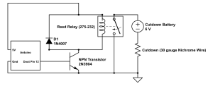
For our cutdown we used a ‘thermal knife’ made of 30 gauge nichrome wire (a type of wire also used in toasters). To trigger the cutdown we used an Arduino Uno board and the “ultimate GPS“ from Adafruit. The Arduino checks the GPS coordinates every 60 seconds, and if the GPS has crossed some preset line (for example, the balloon is 30 miles from an ocean or great lake) sends the cutdown signal. Alternatively, you could use a limit on time aloft to trigger the cutdown. The Arduino cutdown signal triggers a transistor to switch on a reed relay, which completes a circuit with the nichrome wire and a battery pack. The reed relay is needed because the large amount of current that flows through the cutdown circuit loop would fry the transistor! A circuit diagram (created with Circuit Lab) is shown below:
Cutdown circuit diagram
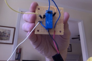
And picture of the circuit soldered on perf board:
Cutdown Circuit
We used a battery pack with 4AAs to power the cutdown, which provides sufficient current to get the nichrome wire glowing red hot:
Glowing Hot Nichrome Wire
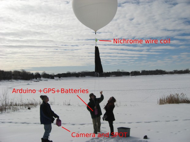
For balloon flight, the nichrome cutdown wire was coiled around the line between the balloon and the payload and sheathed in heat shrink tubing. The setup is shown below:
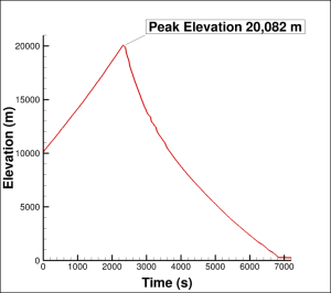
 As a first test of our cutdown mechanism, we launched a balloon with the Arduino set to trigger the cutdown at 20,000 m. Our blog post about the launch is here, and pictures from that cold snowy day are here. As show below the cutdown worked perfectly, terminating the ascent at 20,082 m:
Elevation recorded by GPS during flight.
The Arduino sketch that we made to do all of this is based on the Adafruit Ultimate GPS Library, and is available here.


how do u set the preset bundrys for the gps, so that your balloon will not go past a certain point.
Sorry for taking so long to reply. You can ‘geofence’ or set altitude limits. On the zlog z it is done by adjusting a systems file on the memory card in the device. I hope this helps. Chris